Atlas F 577-6
Squadron: 577th SMS
Date Activated: June 1st 1961
Date Deactivated: March 25th 1965
Air Force Base: Altus
State: Oklahoma
Nearest Town: Frederick
Coordinates:
Latitude: 34°26'16.50"N
Longitude: 99° 0'52.56"W
Decimal:
Latitude: 34.437917
Longitude: -99.0146
GPS:
Latitude: 34 26.275
Longitude: -99 0.876
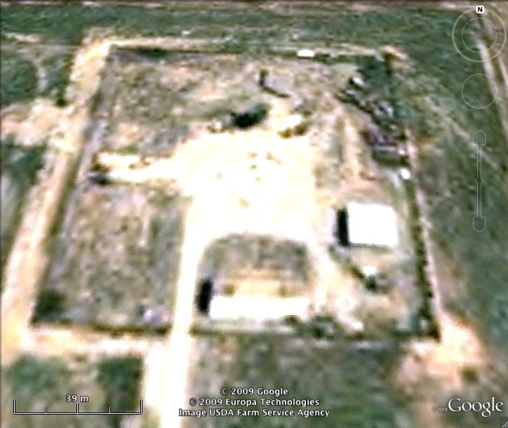
Former Atlas F Launcher with the 577th Strategic Missile Squadron. On May 14th 1964, during a propellant loading exercise, an explosion caused the destruction of this complex. Two days later Defense Secretary McNamara ordered the accelerated phaseout of Atlas and Titan I ICBMs.
Read about the Atlas at Altus AFB
List of all Atlas F site Coordinates