Atlas D 576-B
Date Activated: June 19th 1959
Date Deactivated: November 7th 1967
Air Force Base: Vandenberg
State: California
Coordinates:
Latitude: 34°47'28.90"N
Longitude: 120°35'42.08"W
Decimal:
Latitude: 34.791361
Longitude: -120.595022
GPS:
Latitude: 34 47.4816666666667
Longitude: -120 35.7013333333333
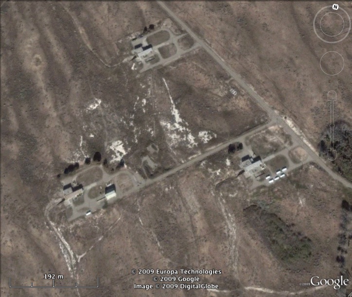
3 sites located here. Site 1 was active from July 22nd 1960 to June 10th 1966. Site 2 was active from June 19th 1959 to November 7th 1967. Site 3 was active from September 12th 1960 to January 21st 1965, then was used for the space program from May 27th 1965 to October 11th 1967.