Atlas D 564-A-1,2,3
Wing: 389th SMW
Squadron: 564th SMS
Date Activated: July 1st 1958
Date Deactivated: September 1st 1964
Air Force Base: F.E. Warren
State: Wyoming
Nearest Town: Cheyenne
Coordinates:
Latitude: 41°22'43.84"N
Longitude: 104°58'12.14"W
Decimal:
Latitude: 41.378844
Longitude: -104.970039
GPS:
Latitude: 41 22.7306666666667
Longitude: -104 58.2023333333333
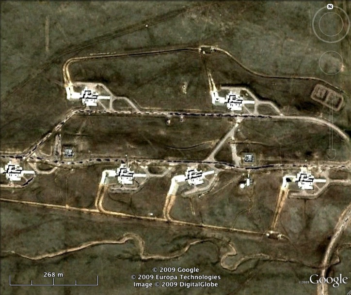
This was the nations first ICBM base outside Vandenberg AFB. Because the Atlas D was radio controlled above ground, the launchers had to be clustered close to the radio transmitters. This site was colocated with 564-B, together the two sites were referred to as "Warren I", or "Site A".
Read about the Atlas at F.E. Warren AFB
List of all Atlas D site Coordinates